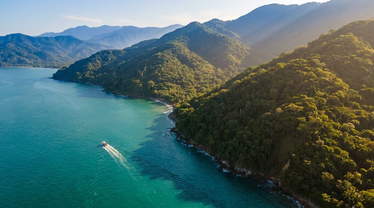
Most people arrive in Puerto Vallarta with a list of activities and no sense of geography. That is the single reason first trips here feel rushed. The activities are not the problem — the distances between them are. Puerto Vallarta is not one destination; it is three adventure zones stacked against each other, and each one asks for a different kind of day. Once you can see the map, planning stops being guesswork.
Why the geography here is unusual
Banderas Bay is one of the largest bays in the Americas, and unusually deep — the seabed drops away sharply not far from shore. Behind the city, the Sierra Madre Occidental rises almost immediately, so the mountains do not sit politely in the distance the way they do in most beach towns. They start at the edge of the neighborhoods.
The practical consequence is that you can be snorkeling in open water at nine in the morning and standing in cloud forest by two in the afternoon, but only if you know which direction you are going. Every adventure in this region belongs to one of three zones, and the mistake almost everyone makes is trying to combine two of them on the wrong day.
Zone 1: the bay — everything that happens on water
This is the zone people picture when they book the trip. It covers the whole arc of water from Nuevo Vallarta in the north to Yelapa in the south, and it includes the widest range of experiences: snorkeling at Los Arcos, sailing to the Marietas Islands, whale watching between December and March, and the offshore fishing grounds that put this bay on the map for anglers.
The bay rewards early starts. Wind builds through the afternoon almost every day of the year, so a boat that leaves at eight is on flat water and a boat that leaves at one is not. If you are choosing between boat tours and fishing charters in Puerto Vallarta, the deciding factor is usually how far you want to go: a half day keeps you inside the bay, a full day gets you to the offshore structure where the big fish live.
A detail worth knowing: the south shore villages — Las Ánimas, Quimixto, Yelapa — have no road access. You reach them by water taxi from Boca de Tomatlán, which turns a beach day into a small expedition and is one of the best-value things you can do here.
Best for
Snorkeling, whale season, sport fishing, sunset sails, and anyone who wants the classic postcard version of this coast.
Zone 2: the jungle south shore and the river valleys
Head south past Mismaloya or inland along the Río Cuale and the landscape changes fast. This is the zone of canopy tours, river crossings, waterfalls and the ATV and horseback trails that run up into the foothills. It is close — most of it is within forty minutes of the Zona Romántica — and it is where the temperature drops a few welcome degrees.
What surprises visitors is how green it is. Puerto Vallarta is technically tropical dry forest, but the river valleys hold water year-round, which is why the jungle here looks like jungle rather than scrub. In the rainy season, roughly July through October, the waterfalls run hard and the trails get genuinely muddy — that is the good version if you like adventure and the difficult version if you were expecting a gentle walk.
This is the zone where guided operators earn their fee. Trail networks are not signposted, river levels change, and the difference between a great day and a miserable one is usually the guide. Operators running ATV, zipline and horseback tours in Puerto Vallarta know which routes are passable on a given week, which matters more here than anywhere else in the region.
Best for
Ziplines, ATVs and RZRs, horseback riding, waterfall hikes, and travelers who want adrenaline without a boat.
Zone 3: the sierra and the mountain towns
The third zone is the one most visitors never reach, and it is the one that changes how people think about this region. Climb inland and the coast disappears behind you: pine and oak forest, cool mornings, old mining towns like San Sebastián del Oeste, and roads that switchback for an hour at a time.
Distance is the honest obstacle. San Sebastián is roughly a two-hour drive each way, so it is a full day and not a morning. Mascota and Talpa are further still. The trade is real, though — you get a completely different Mexico, cobblestone and cold coffee mornings, an hour and a half from a beach chair.
The mountain zone also holds the best hiking in the region, and it is the answer to the question people ask on their fourth day, when they have run out of beach. If you are building a longer stay, a general Puerto Vallarta visitor guide is worth reading before you commit a whole day to the drive.
Best for
Day trips, colonial towns, cooler weather, birding, hiking, and anyone staying longer than a week.
How to combine the zones without wasting days
Here is the rule that fixes most itineraries: never plan two zones in one day, and never plan the same zone two days in a row. The first half of that rule saves you from traffic. The second saves you from boredom.
A four-day trip that works, in practice:
- Day 1 — bay. Arrive, stay close, swim, walk the Malecón at sunset. Nothing that requires a car.
- Day 2 — jungle. Early pickup for ziplines, ATV or horseback. You are back by mid-afternoon with time to recover.
- Day 3 — water, properly. A full-day boat trip: Marietas, the south shore, or a fishing charter. This is the day worth protecting.
- Day 4 — sierra or slow. Either commit to the mountain day trip or do the opposite: a surf lesson in the morning and a long lunch.
That last option is more popular than people expect. The beach break at Sayulita and the gentler sand-bottom waves north of the bay are genuinely good places to learn, and a two-hour session is the least demanding way to spend a morning in the water. Schools offering surf lessons in Puerto Vallarta handle the transport, which removes the only complicated part.
Seasons change the map
The three zones are not equally good all year, and pretending otherwise is how people end up disappointed.
- December to March. Peak season, dry, calm water, humpback whales in the bay. The best window for everything on the water, and the busiest.
- April and May. Quietly the best months. Warm water, thinning crowds, dry trails, prices easing.
- June to October. Rainy season. Afternoons get dramatic, the jungle turns spectacular, the sierra is green, and the sea is warm. Mornings are usually clear — build the day around them.
- November. The reset. Everything is green from the rains, the humidity breaks, and the high-season crowds have not arrived.
What to book ahead and what to leave open
Book ahead: whale watching in season, Marietas Islands access (it is capped by permit), fishing charters, and anything on a holiday week. These genuinely sell out.
Leave open: beach days, water taxis to the south shore, the Malecón, and most food. Weather here is local and moves fast, and having one flexible day is worth more than a perfectly packed schedule. If you want a wide menu of options to draw from when a day opens up, browsing things to do in Puerto Vallarta the night before is usually enough lead time for anything except the list above.
Getting between the zones
Distances look small on a map and behave differently in practice. The airport road through the hotel zone is the chokepoint, and it is slow between roughly 8 and 10 in the morning and again from 5 to 7 in the evening. Anything that crosses town — a Nuevo Vallarta hotel to a Boca de Tomatlán departure, for example — should be planned with an extra forty minutes.
Most tour operators include hotel pickup, and it is worth taking even if you have a car, because parking at trailheads and marinas ranges from complicated to nonexistent. For everything else, taxis and app-based rides work well inside the city. A full breakdown of routes and costs is the sort of thing worth checking in a dedicated getting-around guide before you rent anything.
Frequently Asked Questions
How many days do I need to see all three zones?
Four days is the realistic minimum for one solid day in each zone plus a buffer day. Five to seven is comfortable. With three days or fewer, pick two zones and do them properly rather than sampling all three badly.
Which zone is best for families with young children?
The bay, followed by the gentler end of the jungle zone. Calm-water snorkeling trips, the south-shore beach hops and short canopy circuits work well with kids. Long offshore crossings and full-day ATV routes are better once children are older.
Can I do the sierra without a tour?
Yes, if you are comfortable driving mountain roads. The route to San Sebastián del Oeste is paved and in good condition, but it is a long day with switchbacks and limited services. Many visitors prefer a guided day trip precisely so they can look out the window.
Is the rainy season a bad time to visit?
No, and it is often the best value. Rain here usually falls in the late afternoon or overnight rather than all day. Mornings are typically clear, the landscape is at its greenest, and the water is warmest. The trade-off is humidity and muddier trails.
What is the one thing most first-time visitors get wrong?
Underestimating how much of the day a crossing costs. People book a morning jungle tour and an afternoon sunset cruise on the same day, then spend the middle of it in a van. Do one thing per zone, per day.
Ready to map out your days?
Compare the bay, the jungle and the sierra, and lock in the ones that sell out first.
Explore all tours →