Five kilometres of jungle stairs, tiny coves and open rock between the last road on the south shore and a beach you leave by boat. Here is how to do it on your own.
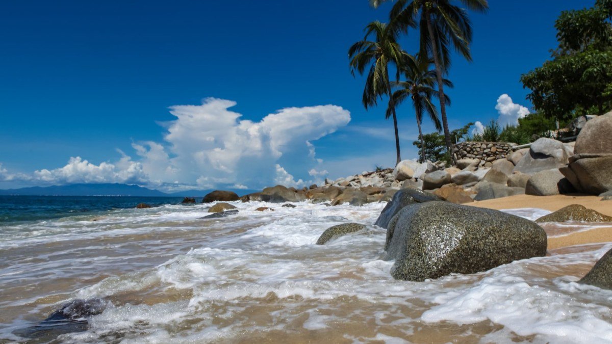
Playa Las Ánimas. Photo: Freepik.
South of Puerto Vallarta the highway turns inland at Boca de Tomatlán, and the coast keeps going without it. The hike from Boca de Tomatlán to Las Ánimas follows that roadless shore on foot, stitching together jungle stairs, small coves and stretches of open rock until it reaches a long beach of palapa restaurants, where a water taxi takes you back. It costs very little, needs no guide and no permit, and it remains one of the best days out you can have from Vallarta.
This guide covers the whole outing: how to reach the trailhead, what the path is really like, where to stop, how to get home, what to carry and what the day costs. The fares below are recent reported ranges, not official tariffs, and they move, so treat them as a budget guide and carry a little extra cash.
The Hike at a Glance
- Distance: about 5 km one way (published figures run from 4 to 5 km).
- Elevation gain: roughly 120 m in total, all of it in short climbs. The high point is only about 60 m above the sea.
- Walking time: around 2 hours without stops, 3 to 5 hours with swims and lunch.
- Difficulty: easy to moderate. The hard part is the first section, up to Colomitos.
- Surface: roughly half concrete and stone steps, the rest dirt path, rock and sand.
- Direction: one way. There is no road out of Las Ánimas, so you return by boat.
- Best months: November through April.
Check This Before You Go
Hurricane Simon moved along this coast in October 2026, and we have not found a published report on the state of the trail since then. Storms on this shore tend to bring down trees, wash out steps and damage the footbridge at Boca. Before you commit, ask at your hotel or at the boat dock in Boca whether the path is clear all the way through and whether the water taxis are running. If the answer is vague, plan to go only as far as Colomitos and walk back, or go by boat.
How to Get to Boca de Tomatlán
Boca sits about 16 km south of downtown on Highway 200, past Mismaloya. You have three realistic options.
By bus
This is the classic way, and the cheapest. White-and-orange city buses signed Boca or Mismaloya leave from the Zona Romántica; the usual boarding point is the corner of Basilio Badillo and Constitución. Reported fares range from about 10 to 20 pesos each way, so keep small bills and coins ready. Confirm with the driver that the bus goes all the way to Boca, because some stop at Mismaloya. Allow 45 minutes to an hour, depending on traffic, and ask to get off at the bridge.
By taxi or Uber
Expect roughly 150 to 250 pesos from the south side of town, and more from Marina Vallarta or the hotel zone. Ask for the bridge in Boca de Tomatlán rather than a street address. It is the sensible option for three or four people, or for an earlier start than the bus allows.
By rental car
There is some parking near the start, but it is informal and fills on weekends. Remember that you will finish the walk by boat to Boca, not to wherever else you might fancy going, so the car ties you to that return route.
Finding the Start of the Trail
From the highway, walk down into the village toward the river. The trail begins on the far bank of the Horcones River, so the first job is to cross it. Many guides describe a pedestrian bridge here, while others report it destroyed by a past hurricane and a crossing further inland. If the bridge is out, follow the river upstream and ask anyone on the street; locals point walkers the right way every day. Once across, take the path along the shore with the sea on your right, and keep it on your right for the rest of the hike. Signs are limited, and side stairs lead to private homes, so when in doubt, choose the option that stays near the coast.
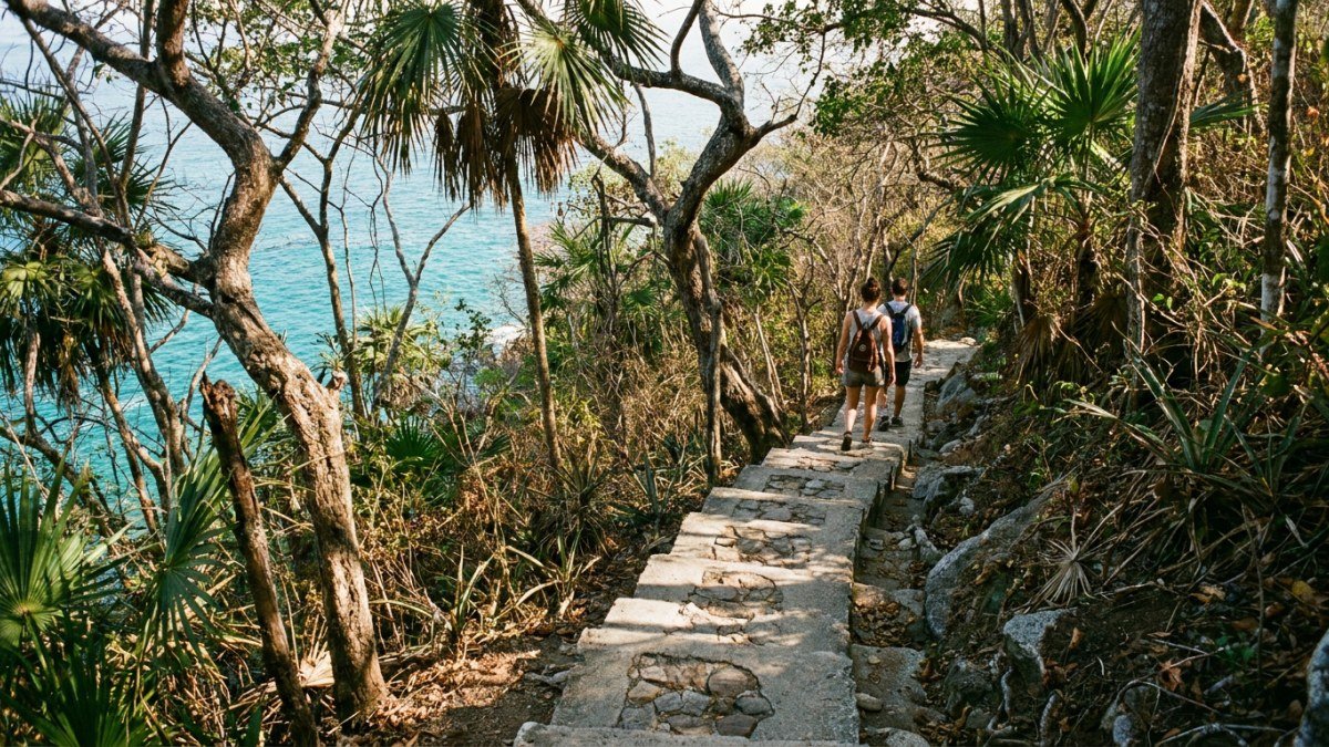
Illustrative image: the first stretch of the trail is mostly stairs.
Section One: Boca to Playa Colomitos
Allow 30 to 45 minutes. This is the toughest part of the day, and it comes first: uneven stone and concrete steps, exposed roots, narrow ledges and several short, steep climbs that will have you sweating even in January. A fair share of it is shaded, and there are good viewpoints over the bay once you have gained some height.
Playa Colomitos is a tiny cove of green water at the foot of the jungle, and it is the natural first swim. It is also the busiest stop on the route. Morning is the time to be here, and on weekends it fills quickly. High tide can swallow much of the sand. The Ocean Grill restaurant sits above the cove and is best reserved in advance.
One navigation trap: stairs climb inland from Colomitos beside the river, and they are not the trail. Cross the beach and look for the stairs on the far side to carry on along the coast.
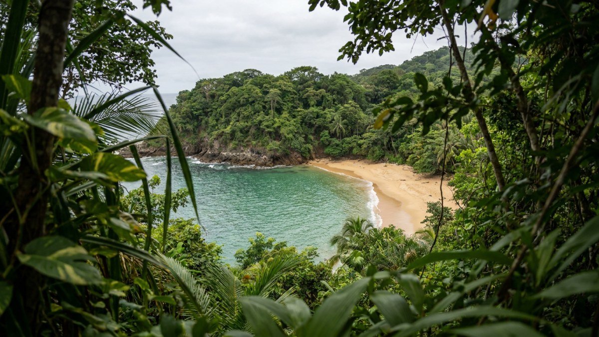
Illustrative image: the coves along the route are small and reached by stairs.
Section Two: The Quiet Middle
Past Colomitos the walking gets easier and the crowds thin out. The path mixes concrete, dirt and short sand crossings, and it passes a string of small beaches that many people have to themselves on a weekday. Playa Madagascar comes up about ten minutes along, then the rocky stretches around Hacamiya and La Troza, where the waves break right beside the path. Watch your footing at the gaps in the rock, and pick your moment if the surf is up. AllTrails reviewers warn that high tide can leave you wet on these low sections.
Parts of this section run behind private houses and building sites. It is not a wilderness trail, and that is part of its character: you are walking through the way this coast actually lives, with no road, supplies arriving by boat and a few houses perched above the water.
Lunch or a break at Casitas Maraika
Casitas Maraika is the classic halfway break, known for fresh fish, guacamole, coffee and cocktails on the water. Beyond the shops in Boca, it is the first reliable place to buy something on the trail. Check that it is open if you are counting on it, especially in low season.
Section Three: Playa del Caballo and the Finish
The last quarter of the route is the easiest. Playa del Caballo, a quiet beach right by Las Ánimas, is worth a look if you want a calmer swim than the one waiting at the finish. Then the path drops onto Playa Las Ánimas, a long stretch of sand lined with palapa restaurants, with a small pier in the middle.
Las Ánimas works differently from the coves. It is livelier, with chairs, seafood, music and, in season, day-trip boats, plus water activities on offer. Many walkers feel the trail is the real prize and the beach simply a reward at the end, and that is a fair way to approach it. Sit down, order grilled fish and a cold drink, and enjoy not having anything left to climb. Chairs are often free when you buy food or drinks, but ask first. Some restaurants take cards; bring pesos anyway.
Want to Go Further? On to Quimixto
Strong walkers with an early start can continue to Quimixto, about 40 minutes beyond Las Ánimas. From the beach there it is another 20 to 30 minutes inland to a waterfall with a swimming hole. The full route comes to roughly 8 km one way. It is a real step up in effort, and you will need a boat out of Quimixto, so ask about departures before you leave Las Ánimas. If you would rather see the south shore's far end without the walk, read our Yelapa beach guide.
How to Get Back: The Boat Is Part of the Plan
There is no road out of Las Ánimas, so unless you walk the whole way back, you leave on the water. Pangas run from the pier to Boca de Tomatlán through the afternoon. The ride takes about 10 to 15 minutes, and the most recent reports put it at around 100 pesos per person, with older reports of 50 pesos and at least one hiker quoted 200. Agree the price before you board, and have cash ready.
- Back to Boca, then the bus: the cheapest route. Northbound buses pass on the highway every 15 to 20 minutes, and you pay the same small fare as on the way out.
- Direct to Los Muertos Pier: some boats continue to town, which saves the bus but runs far less often and costs more. Recent reports vary widely, and the round trip from the pier is quoted at about US$25 to $30, so ask at the dock.
- Last boats: usually around 5 or 6 pm depending on the season. Confirm the time as soon as you arrive. You may wait a while on a busy day, and sometimes over an hour, so do not leave it to the last departure.
Rough water can cut service short. If the sea is up and the boats stop, walking back is your only option, which is another reason to reach Las Ánimas with plenty of daylight left. If you would rather skip the logistics, guided tours from Vallarta and private boat trips on the bay reach the same beaches from the water.
What to Pack
- Water: at least 2 litres per person, 3 in hot months. You can buy some in Boca, but supplies after that are limited.
- Footwear: sturdy sandals are enough for many walkers. Trainers feel safer on wet steps and rock.
- Sun protection: hat, sunglasses and reef-safe sunscreen. Part of the path is shaded, but the rock sections are fully exposed.
- Insect repellent: mosquitoes can be a nuisance in the shaded jungle stretches.
- Swimwear and a light towel. Wear the swimsuit under your clothes.
- Cash in small bills: for buses, boats, food and tips.
- A snack and a dry bag or zip bag for your phone, since boarding a panga can mean wading.
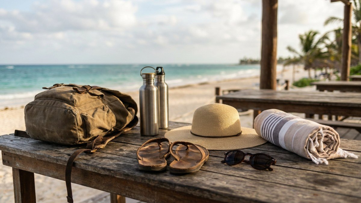
Illustrative image: a small pack with plenty of water is all you need.
What the Day Costs
This is a budget outing. Per person, using recent reported ranges:
- Bus out and back: about 20 to 40 pesos in total.
- Water taxi to Boca: about 100 pesos.
- Water and snacks: about 100 pesos.
- Lunch at Las Ánimas: about US$15 to $30, drinks included, at palapa restaurant prices.
The transport comes to around 150 pesos, which makes this one of the cheapest full days available from Vallarta. Taxis in place of buses add 300 to 500 pesos for the group.
When to Go
November through April is the comfortable season, with dry paths and lower humidity. From December through March you may spot humpback whales from the headlands. The months from June to October are hot, humid and stormy. The steps turn muddy and slick after rain, so start at dawn and aim to be off the trail before the afternoon storms build. Our Puerto Vallarta weather guide breaks the seasons down month by month.
Whatever the month, start early. Leaving Vallarta around 8 am puts you at Colomitos before the crowds, gives you time for a long lunch and leaves room in the afternoon for the boat.
Who Should (and Should Not) Do It
Anyone reasonably fit and comfortable on stairs can manage it. It is not suitable for strollers or for anyone unsteady on narrow ledges, and children under about seven may struggle with the first section, though plenty of older kids love it. If that first stretch sounds like too much, take the boat to Las Ánimas and walk part of the trail from the easy end. For more walks around the city, see our guide to hiking trails near Puerto Vallarta, and for coves you can only reach on foot or by boat, our list of secret beaches.
Frequently Asked Questions
How long is the hike from Boca de Tomatlán to Las Ánimas?
About 5 km one way, or 4 to 5 km depending on the source. Allow around 2 hours of walking, and 3 to 5 hours with swims and lunch.
Is the hike hard?
It is easy to moderate. The first 30 to 45 minutes to Colomitos are the most demanding, with uneven stairs and short climbs. After that it gets much easier.
Do I need a guide or a permit?
No. The route is walked independently every day and no permit is required. Signage is limited, so keep the sea on your right and stay near the coast.
How do I get back from Las Ánimas?
By water taxi from the pier. Boats to Boca take 10 to 15 minutes and recently cost around 100 pesos per person. Some boats go directly to Los Muertos Pier for more. Confirm the price and the last departure when you arrive.
What time is the last boat from Las Ánimas?
Usually around 5 or 6 pm, depending on the season and the sea. It is not a fixed timetable, so ask as soon as you reach the beach.
Can I do it in sandals?
Many people do, in sturdy sandals with a back strap. Flip-flops are a bad idea on the stairs, and trainers are better after rain.
Is there food along the trail?
Yes, but not much. Ocean Grill at Colomitos needs a reservation, Casitas Maraika is the main mid-route stop and Las Ánimas has plenty of restaurants. Carry your own water and a snack.
Is the trail open after Hurricane Simon?
We could not find a published report on the trail since the storm of October 2026. Ask at your hotel or at the dock in Boca before you set out, and check that the water taxis are running.
Prefer to see this coast from the water?
Compare guided outings and boat days along the south shore of Banderas Bay.
See Puerto Vallarta tours →